💠 Vector Data
For vector data visualization, EOmaps utilizes the plotting capabilities of geopandas .
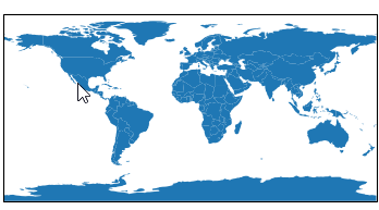
A geopandas.GeoDataFrame can be added to the map via Maps.add_gdf().
This is basically just a wrapper for the plotting capabilities of geopandas
(e.g. GeoDataFrame.plot(…) )
supercharged with EOmaps features.
If you provide a string or pathlib.Path object to
Maps.add_gdf(), the contents of the file will be read into aGeoDataFramevia geopandas.read_file().Many file-types such as shapefile, GeoPackage, geojson … are supported!
Plot a geopandas.GeoDataFrame on the map. |
from eomaps import Maps
# import geopandas as gpd
# gdf = gpd.GeoDataFrame(geometries=[...], crs=...)<>

m = Maps()
# load the "ocean" data from NaturalEarth as a GeoDataFrame
gdf = m.add_feature.physical.ocean.get_gdf(scale=50)
# add the GeoDataFrame to the map
m.add_gdf(gdf, fc="r", ec="g", lw=2)
It is possible to make the shapes of a GeoDataFrame pickable
(e.g. usable with m.cb.pick callbacks) by providing a picker_name
(and specifying a pick_method).
use
pick_method="contains"if yourGeoDataFrameconsists of polygon-geometries (the default)pick a geometry if geometry.contains(mouse-click-position) == True
use
pick_method="centroids"if yourGeoDataFrameconsists of point-geometriespick the geometry with the closest centroid
Once the picker_name is specified, pick-callbacks can be attached via:
m.cb.pick[<PICKER NAME>].attach.< CALLBACK >()
For example, to highlight the clicked country, you could use:
from eomaps import Maps
m = Maps()
# get the GeoDataFrame for a given NaturalEarth feature
gdf = m.add_feature.cultural.admin_0_countries.get_gdf(scale=110)

# pick the shapes of the GeoDataFrame based on a "contains" query
m.add_gdf(gdf, picker_name="countries", pick_method="contains")

# temporarily highlight the picked geometry
m.cb.pick["countries"].attach.highlight_geometry(fc="r", ec="g", lw=2)